Weather alert for Spain: New Atlantic storm could bring fresh rain this week
By Farah Mokrani • Published: 15 Mar 2026 • 20:18 • 3 minutes read
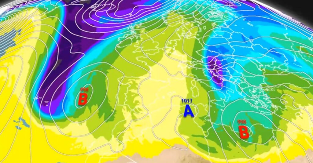
Weather models show a new Atlantic storm forming near Spain. Credit : Meteored
Spain may not be done with unsettled weather just yet. Meteorologists are watching a developing Atlantic weather system that could form just off the Iberian Peninsula this week, potentially bringing another round of rain to parts of the country. According to forecast models analysed by the weather platform Meteored, a cold isolated storm system could develop near Portugal and the Azores, increasing the likelihood of wetter-than-usual conditions in parts of southern Spain and the Canary Islands.
For residents and expats who thought the recent rainy spell might be over, the latest projections suggest the atmosphere still has a few surprises left before spring settles in.
Atlantic storm system forming near Spain could bring more rain
Weather models currently indicate that a deep Atlantic trough may drop southwards towards the Iberian Peninsula over the coming days. When this happens, it can trigger the formation of a surface low-pressure system.
Meteorologists say this potential system could develop into what is known as a cold isolated storm, sometimes referred to as a BFA (Borrasca Fría Aislada). It behaves in a similar way to the better-known DANA weather phenomenon, but it typically has a more clearly defined low-pressure centre at the surface.
If the storm intensifies enough, it could even receive an official name – Samuel – under the European storm naming system.
The reason this weather pattern is developing lies much further north. Forecast models suggest that a high-pressure blocking system may form over northern Europe, stretching across areas including the UK, Sweden and Finland.
When strong high pressure builds in these latitudes, it often forces Atlantic storms to move further south than usual. As a result, Spain and southern Europe can end up directly in the path of these weather systems.
Meteorologists refer to this pattern as a Scandinavian blocking system, and it is often linked with prolonged rainy episodes across the Iberian Peninsula.
Rain likely in southern Spain and the Canary Islands
If the current forecast scenario holds, the first region to notice the impact of the approaching storm will likely be the Canary Islands.
Weather models indicate that rainfall could begin there from Wednesday, with some showers potentially becoming heavy at times. Winds are also expected to shift to a south-westerly direction, which typically signals the arrival of Atlantic systems in the archipelago.
Meanwhile, mainland Spain could experience a more complex weather setup.
By Thursday, March 19, meteorologists say the atmosphere may develop into what is known as an “Omega blocking” pattern, named after its resemblance to the Greek letter Ω on weather charts.
In this configuration, a large high-pressure system stretches from North Africa to the British Isles, while two low-pressure areas sit on either side – one near Portugal and another over central Europe.
This pattern can trap weather systems in place, sometimes prolonging rainy conditions in the regions affected.
In this case, the Canary Islands could see the most persistent rainfall, while mainland Spain may experience more variable conditions depending on how the system evolves.
Southwest Spain could see above-average rainfall
According to precipitation anomaly maps produced by the European forecasting model, the coming week could bring higher-than-average rainfall to parts of southwestern Spain.
The areas most likely to see additional rain include western Extremadura and parts of Andalusia, where rainfall totals could exceed seasonal averages by 10 to 30 litres per square metre.
By contrast, northern regions such as Galicia and the Cantabrian coast may experience drier conditions during the same period.
If the weather pattern continues to develop as expected, meteorologists believe the final week of March could also bring further rainfall across southern Spain, the Mediterranean coast, the Balearic Islands and the Canary Islands.
However, forecasters emphasise that there is still a degree of uncertainty, particularly with medium-range forecasts.
What this means for residents and expats in Spain
For many residents across Spain – especially expats living in popular regions such as Andalusia, the Costa del Sol, Alicante or the Balearic Islands – the recent weather has already felt unusually unsettled.
After months of drought concerns in previous years, the return of regular rainfall has been welcomed in some areas, particularly where reservoir levels had fallen.
At the same time, persistent rain can disrupt travel plans, outdoor events and tourism activities, particularly as the country approaches the busy spring holiday season.
Meteorologists stress that while the potential storm system could bring another wet spell, conditions can still shift quickly depending on how the Atlantic weather pattern evolves.
For now, weather experts recommend keeping an eye on updated forecasts over the coming days.
Spring may be approaching, but if the current models are correct, Spain could still see a few more rainy days before the sunshine returns for good.
Sign up for personalised news
Subscribe to our Euro Weekly News alerts to get the latest stories into your inbox!
By signing up, you will create a Euro Weekly News account if you don't already have one. Review our Privacy Policy for more information about our privacy practices.


Farah Mokrani
Farah is a journalist and content writer with over a decade of experience in both digital and print media. Originally from Tunisia and now based in Spain, she has covered current affairs, investigative reports, and long-form features for a range of international publications. At Euro Weekly News, Farah brings a global perspective to her reporting, contributing news and analysis informed by her editorial background and passion for clear, accurate storytelling.
Comments