Jorge Rey alerts of ‘historic’ temperature plunge for late August: What do the official models and AEMET say?
By Adam Woodward • Published: 23 Aug 2026 • 13:31 • 2 minutes read
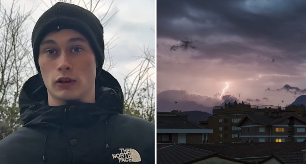
Jorge Rey warns of strong storms coming to Spain. Credit: JR & Bittor Imanol - Shutterstock
Jorge Rey, the popular Spanish weather forecaster known for his traditional cabañuelas forecasts, has highlighted a sharp and unusual drop in temperatures for the final days of August, describing it as historic and capable of overturning typical late-summer expectations.
His latest outlook points to a drammatic cooling after weeks of above-average heat, accompanied by strong storms in parts of the country.
Do official forecasts and models back an unusually sharp change?
AEMET’s medium-range guidance and the European model (ECMWF) do support a clear shift toward cooler and more unsettled conditions in the last week of the month, though Rey’s language of a “historic” plunge is stronger than the official wording and is concerning weather watchers.
According to AEMET’s conservative latest three-week outlook (updated mid-to-late August), the period from 24 to 30 August is expected to feature temperatures below the seasonal average across much of the interior and especially the western half of the peninsula. Rainfall is also forecast to be above normal for late August in many areas. Coastal zones and the archipelagos are more likely to stay closer to normal or slightly warmer.
The ECMWF sub-seasonal outlook reinforces this picture. For the week of 24–31 August, it shows widespread negative temperature anomalies across the peninsula, generally in the range of 1 to 3 °C below the long-term average, with larger departures (up to 3 to 6°C cooler than normal) possible over parts of Extremadura, Madrid, Castilla y León, Castilla-La Mancha and Galicia. The pattern is linked to a more mobile, wavy jet stream and the influence of Atlantic systems rather than the persistent subtropical ridge that dominated earlier in the month.
In the shorter term, a notably deep Atlantic low is already approaching. AEMET has described it as unusually intense for August; its effects are expected to bring further cooling, rain (especially in the northwest) and storms from Monday onwards. This follows a period of instability and some notable temperature falls in northern and eastern areas around the third weekend of August, when maximums in parts of the Cantabrian region and Castilla y Leon dipped toward or below 20 to 25°C in places, values that felt decidedly unseasonable after the preceding heat.
Bottom line
There is solid model and AEMET support for a genuine change of pattern: cooler-than-average temperatures for late August in many inland and western areas, increased storm and rain risk, and a break from the intense heat of earlier weeks. Whether the drop qualifies as “historic” depends on the precise locations and the final numbers that materialise. Late-summer transitions with Atlantic systems are not rare, but the combination of a deep low and the projected negative anomalies would bring a noticeable and relatively sharp turn for the final days of the month.
Expats and those with holidays booked should monitor the latest AEMET warnings, particularly for thunderstorms, hail and strong winds in the north and east in the coming days, and expect a more changeable, cooler feel in many inland areas as August draws to a close.
Follow Euro Weekly News on Google News
Get breaking news from Spain, travel updates, and expat stories directly on your Google News feed.
Follow on Google NewsSign up for personalised news
Subscribe to our Euro Weekly News alerts to get the latest stories into your inbox!
By signing up, you will create a Euro Weekly News account if you don't already have one. Review our Privacy Policy for more information about our privacy practices.

Adam Woodward
Adam is a writer who has lived in Spain for over 25 years. With a background in English teaching and a passion for music, food, and the arts, he brings a rich personal perspective to his work at Euro Weekly News. As a father of three with deep roots in Spanish life, Adam writes engaging stories that explore culture, lifestyle, and the everyday experiences that shape communities across Spain.
Comments