Spain preparing for 45ºC scorcher and fierce east coast storms as the third heatwave hits from Tuesday
By Adam Woodward • Published: 19 Jul 2026 • 12:11 • 3 minutes read
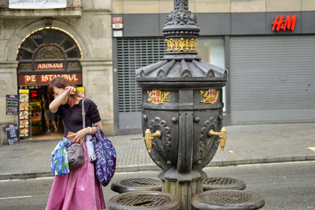
Keep hydrated as Spain enters hottest period. Credit: Francesco Cantone - Shutterstock
Spanish meteorologists at Aemet have confirmed the third real heatwave of summer will arrive on Tuesday, 21 July, and last at least until Thursday, 23 July, bringing even more extreme temperatures that could locally top 45ºC across wide areas of the south-east, Guadalquivir Valley and Ebro Valley.
Daytime peaks are forecast to climb steadily through the first half of the week, with overnight temperatures staying stubbornly high and making nights steamy and sticky.
Temperatures climb hard from Tuesday
Maximums on Tuesday, July 21, are reckoned will reach 39-41ºC across the Ebro Valley, north-eastern depressions, eastern Castilla-La Mancha, the upper and middle Guadalquivir and inland Mallorca as well. The Genil basin could see between 40 and 42ºC, while parts of the inland south-east push 41-43ºC, with isolated spots already threatening as much as 44ºC.
Wednesday, July 22, continues to put pressure on the mercury, especially in the south-western part of the country. Readings of 39-41ºC are still likely in the Ebro Valley, eastern Castilla-La Mancha and inland Mallorca, while the Guadalquivir Valley and nearby sierras, plus the Genil basin, hit 40-42ºC. Inland areas of the south-eastern third look set for 41-43ºC and could again go over 44ºC in places.
Thursday, July 23, is forecast as the peak day of the current heatwave. Expect 37-39ºC inland Mallorca, 39-41ºC in eastern Castilla-La Mancha, 40-42ºC in the Ebro Valley and north-eastern depressions, 41-43ºC in the Guadalquivir Valley, adjacent sierras and Genil basin, and 42-44ºC across the south-eastern third.
El calor será significativo en casi toda la península, pero todo apunta que la peor parte se la llevaría el sureste peninsular🥵
Las máximas podrán alcanzar los 43-44°C e incluso los 45° en esta región.
En el Valle del Guadalquivir también apretará el calor con máximas de hasta… pic.twitter.com/4LTn5uGUGt— Stormyalert (@Stormyalert) July 19, 2026
Local values above 45ºC are possible in the hottest spots
Monday, July 20, already looks very hot even though it sits outside the official heatwave window, with 38-40ºC possible in the Ebro Valley and north-eastern lowlands, 39-41ºC along the upper and middle Guadalquivir and Genil, and 40-42ºC inland in the south-east. Aemet has not ruled out extending the heatwave period backwards if further data supports it.
⚠️ AVISO ESPECIAL | OLA DE CALOR
➡️ Las temperaturas podrán alcanzar valores extremos, superando incluso puntualmente 44 o 45 °C el miércoles y jueves.
➡️ El episodio se prolongará, al menos, hasta el jueves 23.
+ info 👉https://t.co/48Lsr8QC4f pic.twitter.com/gwgjmuy3CH
— AEMET (@AEMET_Esp) July 18, 2026
Summer storms may alleviate the heat
The same intense daytime heating that is powering the high temperatures is also expected to lead to powerful afternoon storms over parts of eastern and south-eastern Spain. Energy built up during the hottest hours, helped by cooler air aloft, is likely to cause strong convective cells from around midday, especially over mountainous and inland zones.
The highest risk centres on the Region of Murcia (particularly the north-west and Altiplano), the south-east of Castilla-La Mancha, including Albacete, and inland areas of the Valencian Community such as Valencia province and southern Castellon. Some storms may stay largely dry yet still produce violent downbursts of energy, wind gusts above 100 km/h, frequent lightning and large hail. Localised heavy showers of 15-20 litres per square metre are possible, occasionally turning muddy because of the thick Saharan dust already in the air.
Mapa de concentración de polvo en suspensión para el lunes y martes en Andalucía y Málaga @ilillom @DiarioSUR @Storm_Malaga pic.twitter.com/MDjsoQCCiR
— Jose Luis Escudero Gallegos (@tormentayrayos) July 19, 2026
Similar activity could spread into neighbouring zones including inland Alicante, the Iberian System, the Pyrenees and parts of inland Catalonia, though generally with less intensity. Storm activity should ease after sunset once surface heating fades.
Stay safe in the extreme conditions
Aemet, the national official meteorological service, has flagged an important level of danger during the middle of the day, particularly for outdoor work and for older people, young children and anyone with heart or respiratory conditions. Fire risk will also stay at extreme levels across many of the hottest districts, raised further by dry lightning and strong gusts.
Keep physical effort to the cooler early morning or late evening; drink plenty of water; check on vulnerable neighbours and relatives; and avoid the countryside during the peak heat and storm window. Coastal spots will feel a little less fierce than inland valleys, but humidity can still make conditions oppressive.
Follow Euro Weekly News on Google News
Get breaking news from Spain, travel updates, and expat stories directly on your Google News feed.
Follow on Google NewsSign up for personalised news
Subscribe to our Euro Weekly News alerts to get the latest stories into your inbox!
By signing up, you will create a Euro Weekly News account if you don't already have one. Review our Privacy Policy for more information about our privacy practices.


Adam Woodward
Adam is a writer who has lived in Spain for over 25 years. With a background in English teaching and a passion for music, food, and the arts, he brings a rich personal perspective to his work at Euro Weekly News. As a father of three with deep roots in Spanish life, Adam writes engaging stories that explore culture, lifestyle, and the everyday experiences that shape communities across Spain.
Comments