Heavy rain lines up for Malaga on Monday as storms drift toward Murcia, Alicante and the Balearics
By Adam Woodward • Published: 27 Sep 2026 • 11:42 • 2 minutes read

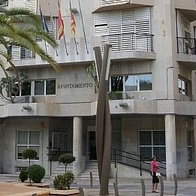
Central Malaga needing umbrellas. Credit: Lapa Smile - Shutterstock
Monday, September 28, is the day to watch on the Costa del Sol. AEMET now gives Malaga city an 80 per cent chance of heavy rain just after midnight, 100 per cent from 6am to midday and 90 per cent through the afternoon putting the province on Yellow Alert for adverse wet weather and possible storms. Highs are expected to fall to around 25ºC. Several model runs used on Meteologix’s Malaga page go further, with Monday as the wettest day of the next fortnight and totals in the heaviest solutions passing 50 litres per square metre.
Inland valleys often catch more than the shoreline. Guadalhorce, Antequera and the Axarquia can run water quickly after a dry spell. Official colour alerts, if they come, will sit on AEMET’s warnings page. Andalucia’s 112 service stepped up to orange in parts of inland Malaga only a fortnight ago, as EWN reported.
Se activa para mañana lunes el aviso amarillo 🟡 por fuertes lluvias en #Antequera, #Sol y #Guadalhorce.
Se esperan +15mm/1h y no se descartan tormentas. ⛈️Avisos activos de 7h a 15h. ⚠️ pic.twitter.com/vPb4CDyuCM
— ElTiempoEnMálaga (@ElTiempoEnMlag1) September 27, 2026
Monday: west first, east later
Western Andalucia takes the first band. Malaga province is the focus. Cadiz and the Strait keep a strong levanter with very strong gusts on exposed ground, so rain there may arrive with messy wind rather than huge totals.
Almeria city looks cooler on Monday, with highs in the mid-20s, with a lower daytime rain chance than Malaga. Inland Almanzora, Los Velez and the Levante Almeriense can still pick up a later shower. Murcia starts greyer than wet. Vega del Segura and the Altiplano need watching if cells fire in the afternoon.
Alicante is expected to turn cloudy from early Monday, with rain more likely from around midday. Valencia city already shows high official rain probabilities through Monday on AEMET’s table. Costa Blanca showers are more likely to be scattered than a single washout, but short bursts still flood underpasses. Mid-September’s Valencia Airport flooding is the recent reminder.
Balearics stay in the same Mediterranean setup: broken cloud, a weak shower possible on Mallorca and Menorca, mist patches. Monday is not the main island threat on current maps, but sea temperatures are still high enough for a sharp cell if cold air arrives overhead.
Tuesday: Levante and the islands
Tuesday is when the East and the Balearics deserve equal billing. Once the first band has crossed western Andalucia, attention shifts to Murcia, Alicante, Valencia and the islands. AEMET’s wider outlook has already pointed that way. Isolated storms are the risk, not a neat line of rain. One town gets a rumble and 20 litres in an hour; the next stays dry.
Malaga should ease on Tuesday, with highs climbing back toward 28C and rain chances falling away. Almeria and Murcia may see their better chance then rather than at Monday dawn. Balearics need a check for locally heavy showers if instability holds.
Yellow or orange rain and storm alerts are most likely where models stack the highest hourly rates: Malaga province Monday, then parts of Murcia, Alicante and possibly Mallorca or Menorca Tuesday. Confirm on AEMET and Meteoalarm before travel.
Practical notes
Keep off dry riverbeds. Allow extra time on the A-7 and into AGP on Monday morning. Mountain roads in Almeria and inland Alicante can cut up after a single cell.
0 Avisos activos. ¿Cuál sería la correcta gestión ante esta situación? Yo creo que ya debería haber avisos activos, (naranja mínimo), y que en caso de tener que enviar alerta roja o Es-Alert, sea el día de antes, y otro el mismo día si la situación se agrava. pic.twitter.com/yc5HZjaVzJ
— Sistema Climático MLG (@SistClimatico) September 27, 2026
Follow Euro Weekly News on Google News
Get breaking news from Spain, travel updates, and expat stories directly on your Google News feed.
Follow on Google NewsSign up for personalised news
Subscribe to our Euro Weekly News alerts to get the latest stories into your inbox!
By signing up, you will create a Euro Weekly News account if you don't already have one. Review our Privacy Policy for more information about our privacy practices.



Adam Woodward
Adam is a writer who has lived in Spain for over 25 years. With a background in English teaching and a passion for music, food, and the arts, he brings a rich personal perspective to his work at Euro Weekly News. As a father of three with deep roots in Spanish life, Adam writes engaging stories that explore culture, lifestyle, and the everyday experiences that shape communities across Spain.
Comments