Valencia braces for torrential rain as storms threaten flash floods
By Adam Woodward • Updated: 30 Sep 2026 • 17:04 • 3 minutes read
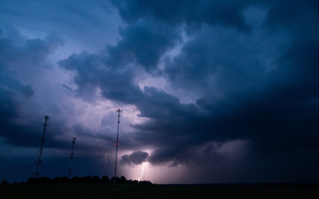
Major storms approach Valencia. Credit: WhiDark - Shutterstock
Heavy rain could dump more than 150 litres per square metre across parts of the Valencia region on Thursday, October 1, with some forecasts pointing to even more.
Those in Valencia, Castellon and northern Alicante are being warned to take particular care as thunderstorms are expected to develop during the afternoon, bringing the chance of torrential downpours, hail and very strong wind gusts.
AEMET, Spain’s state weather agency, has issued orange warnings for heavy rain across parts of Valencia and Castellon, as well as the northern Alicante coast. According to the forecast information supplied for the episode, the warnings run from 2pm until midnight, covering the period when storm activity is expected to be strongest.
The situation is part of a wider change to Spain’s weather after weeks of unusually warm conditions, as we reported recently.
Valencia faces biggest flash flood risk
Cold air higher in the atmosphere combined with moist easterly winds blowing in from the Mediterranean is creating conditions favourable for powerful thunderstorms.
30/09 12:24 AVISOS HOY Y MAÑANA | Comunitat Valenciana: tormentas y lluvias. Nivel máximo de aviso: naranja.
Actualizaciones en https://t.co/R3Fs2JzKgr pic.twitter.com/ATMHAOmfE0— AEMET Comunitat Valenciana (@AEMET_CValencia) September 30, 2026
Rainfall could be particularly intense where individual storm cells become slow-moving or repeatedly develop over the same area. That means one town could receive a huge amount of rain while another’s is completely dry.
Forecast figures indicate that some areas could receive more than 60 litres per square metre in just one hour. Twelve-hour totals could reach around 160 litres per square metre on the northern Valencia coast and southern Castellon coast.
Other parts of the Valencia region could receive more than 120 litres per square metre over 12 hours. Some computer modelling goes further, with the HARMONIE-AROME model indicating more than 100 litres per square metre across broad parts of Valencia and Castellon, as well as Mallorca. Localised totals above 200 litres, and potentially 250 litres, are possible in the worst-affected parts of northern Castellon.
Estamos haciendo los mapas de mañana pero avisar de que mañana es una situación dificil de pronosticar por su gran complejidad y junto a ello también es una situación muy peligrosa.
Antes que nada, avisar a todo el mundo, que va a ir por pueblos y no exageramos que en tu pueblo… pic.twitter.com/XPesfSuR2m
— ValènciaWeather⚡️ (@Valencia_WX) September 30, 2026
Those figures are modelled possibilities rather than guarantees, and the highly localised nature of thunderstorms makes precise totals difficult to predict.
Storms could arrive out of the blue on Thursday
Thursday morning may not give much indication of what is to come later in the day. Storm activity is expected to increase during the afternoon, particularly from the middle of the day into the early evening. Some cells could then move towards the coast while continuing to produce intense rainfall.
Hail and strong wind gusts are also possible, adding further problems for anyone travelling or caught outside.
Recent weather episodes have already shown how quickly conditions can change in eastern Spain. Earlier this month, Alicante was hit by torrential rain, hail and storms as temperatures dropped sharply.
Irregular rainfall is one of the biggest concerns this time. Rather than one large band of rain moving steadily across the region, separate thunderstorm cells could form and repeatedly pass over the same location.
That creates a particular risk around normally dry barrancos, ramblas and river channels, where water levels can rise very quickly.
Orange warning means take extra care
An orange AEMET warning represents an important level of weather danger and should not be treated as simply a forecast for a wet afternoon. People living in affected areas should keep checking the latest AEMET weather warnings, particularly before setting out by car.
Drivers should avoid unnecessary journeys during the worst of the storms where possible. Anyone who does need to travel should take extra care around underpasses, low-lying roads, bridges and areas close to normally dry waterways.
A flooded road can be considerably more dangerous than it first appears. Water may be deeper or moving faster than expected, while visibility can deteriorate rapidly during torrential rain.
⚠️ ATENCIÓ: SUSPENSIÓ DE LES CLASSES demà DIJOUS 1 d'octubre per 🟠 ALERTA TARONJA PER PLUGES I TRONADES i AVÍS ESPECIAL, tal com marca el protocol aprovat pel Consell Escolar Municipal de Gandia. 🌧️⛈️. pic.twitter.com/hsYgZwAjYI
— Ajuntament de Gandia (@aj_gandia) September 30, 2026
Previous severe rainfall events in Spain have also seen emergency services warn people to stay away from ramblas and riverbeds, with authorities stressing that drivers should never attempt to cross a flooded watercourse.
Keep checking the forecast
Exact locations for the heaviest rain are difficult to pin down several hours in advance because thunderstorms can form and stall over a relatively small area.
For British residents and holidaymakers in Valencia, Castellon and Alicante, Thursday is therefore a day to keep plans flexible and check the forecast before travelling.
AEMET’s official forecast service provides updated warnings and predictions by province and municipality, allowing people to check conditions for their particular area rather than relying on a general regional forecast.
Follow Euro Weekly News on Google News
Get breaking news from Spain, travel updates, and expat stories directly on your Google News feed.
Follow on Google NewsSign up for personalised news
Subscribe to our Euro Weekly News alerts to get the latest stories into your inbox!
By signing up, you will create a Euro Weekly News account if you don't already have one. Review our Privacy Policy for more information about our privacy practices.



Adam Woodward
Adam is a writer who has lived in Spain for over 25 years. With a background in English teaching and a passion for music, food, and the arts, he brings a rich personal perspective to his work at Euro Weekly News. As a father of three with deep roots in Spanish life, Adam writes engaging stories that explore culture, lifestyle, and the everyday experiences that shape communities across Spain.
Comments