Weather warning in Spain: Orange-level alerts issued as heavy rain threatens many areas
By Adam Woodward • Updated: 08 Nov 2026 • 8:34 • 4 minutes read
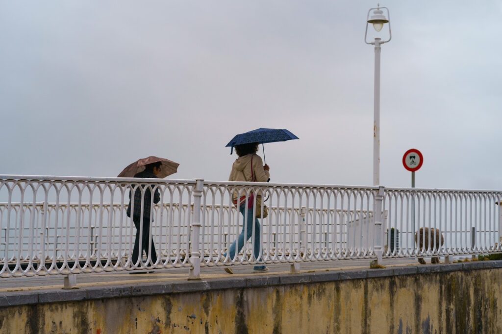
Wet and windy week ahead. Credit: YuryKara - Shutterstock
AEMET warns of flooding, thunderstorms and powerful winds as Storm Bruna brings a difficult start to the week.
Spain is facing another spell of potentially dangerous weather, with the State Meteorological Agency (AEMET) issuing orange and yellow warnings for heavy rain, thunderstorms and strong winds as Storm Bruna moves towards the mainland.
Residents in parts of western Andalucia, Extremadura and other areas are being warned to prepare for heavy downpours, while some parts of the country could receive more than 100 litres of rain per square metre in just 12 hours.
#BuenosDías
Domingo marcado por el cambio de tiempo.
En los próximos días, no olvides el paraguas ☔ y mantente siempre informado a través de los canales oficiales. https://t.co/x8OVNA0aSl
— EMA 112 (@E112Andalucia) November 8, 2026
Although the worst of the weather is expected further west at first, people living along the Costa del Sol, Costa Tropical, Costa Blanca and Costa Calida should keep checking local forecasts as the situation develops.
AEMET’s latest outlook suggests the unsettled conditions could affect large parts of the country until at least Wednesday, November 11, with rain potentially continuing into Thursday and Friday.
Orange weather alerts as rainfall totals climb
Orange warnings, indicating an important weather risk, have been issued for northern Caceres and southern Avila, where exceptionally heavy rainfall is expected overnight from Sunday, November 8, into Monday morning. AEMET forecasts up to 100 litres per square metre in 12 hours in these areas, with the possibility of accumulated rainfall reaching 200 litres over a 72-hour period.
08/11 00:06 AVISOS HOY Y MAÑANA | España: costeros, vientos, tormentas y lluvias. Nivel máximo de aviso: naranja.
Actualizaciones en https://t.co/BLdoSsO2Qv https://t.co/ytz2Ipg1Sy— AEMET (@AEMET_Esp) November 7, 2026
Even more warnings are being issued at yellow level across several other mainland regions. These include parts of Huelva, Sevilla, Badajoz and the Sierra de Grazalema in Cadiz Province. The warnings cover different periods, with some starting late on Sunday evening and others continuing throughout Monday.
Ronda, in Malaga Province, is also included in the yellow rain warnings for Monday, with the surrounding mountain area facing the possibility of substantial rainfall.
People living in these areas should take particular care around rivers, streams and normally dry riverbeds, where water levels can rise quickly following intense rainfall. AEMET’s official weather warning map provides the latest information about affected areas and alert levels.
Which parts of Andalucia are facing the worst conditions?
Western Andalucia is expected to take the brunt of the first major rainfall episode. Huelva Province is among the areas to watch, with yellow warnings covering the Aracena mountains, Andevalo and Condado districts and the coastal area. Parts of Sevilla Province, particularly the Sierra Norte, are also included.
Further east, the Grazalema mountain area in Cadiz Province and the Ronda district in Malaga Province are expected to receive heavy rainfall. For residents of the Axarquia, Malaga city, Nerja, Almunecar and the wider Costa Tropical, the current warning picture is less severe. These areas are not included in the orange rain alerts just yet, although showers and changing conditions cannot be ruled out as successive weather fronts cross the country.
The distinction is important: the highest rainfall totals are expected in the western and mountainous parts of the peninsula rather than across the entire Mediterranean coastline. Previous incidents have demonstrated how dangerous extreme rainfall can become in Malaga Province. A fatal rockfall during heavy rain near Ronda illustrated the risks that can accompany severe weather, particularly for motorists travelling through mountainous areas.
Heavy rain could continue until Wednesday
AEMET says the weather situation is being driven by a large area of low pressure west of the Iberian Peninsula, with Storm Bruna and its associated weather fronts bringing repeated spells of rain. Sunday, November 8, sees the heaviest rainfall concentrated across Galicia, western Castilla y Leon, Extremadura and western Andalucia. Huelva could receive more than 40 litres per square metre, while parts of the Gredos mountain range could record more than 60 litres.
Monday, November 9, is expected to be particularly difficult in several western regions. More than 60 litres could fall across parts of western and southern Galicia, western Spain and western Andalucia. The highest totals are forecast around the western Sistema Central and northern Extremadura, where accumulations could reach 120 to 150 litres per square metre.
Rain is expected to continue across much of the peninsula on Tuesday and Wednesday, although the distribution and intensity will vary considerably between regions.
AEMET expects conditions to start improving progressively from Thursday, November 12, although further heavy showers cannot be ruled out. Its special weather bulletin for Storm Bruna provides further details about the expected rainfall, wind and coastal conditions.
Strong winds and dangerous coastal conditions
Rain is not the only concern. Strong south-westerly winds are expected to accompany the weather system, particularly across exposed mountain areas and parts of the west.
Gusts could exceed 100km/h in some northern mountain locations, with speeds of 70 to 90km/h possible across elevated areas of western and central Spain, Andalucia and the Strait of Gibraltar.
Coastal conditions will also need watching. Waves could reach five to six metres along the western Galician coastline, while the sea off western Andalucia could see waves approaching four metres.
Anyone planning coastal walks or other seaside activities should pay attention to local warnings and avoid exposed promenades, breakwaters and rocky shorelines during rough conditions.
What should residents do during the weather warnings?
Civil Protection has warned that intense rainfall could cause localised flooding, rising river levels and dangerous conditions in low-lying areas.
Drivers are advised to reduce their speed, use main roads where possible and avoid attempting to cross flooded roads, even if the water appears relatively shallow. The Spanish Traffic Authority’s advice for driving during emergencies explains the dangers of flooded roads and sudden rises in water levels.
People should also avoid parking vehicles in flood-prone areas or beside normally dry streams and ravines. Sudden downpours can cause water levels to rise with very little warning.
Anyone living in a vulnerable location should follow instructions from their local council and emergency services. Spain’s Civil Protection service has published further advice as Storm Bruna approaches.
AEMET’s warning levels can change as new forecasts become available, so residents and visitors should check the official weather alert map before travelling.
For anyone in Spain, the message is to take the warnings seriously, particularly if travelling through western Andalucia or the mountainous interior over the next few days.
Follow Euro Weekly News on Google News
Get breaking news from Spain, travel updates, and expat stories directly on your Google News feed.
Follow on Google NewsSign up for personalised news
Subscribe to our Euro Weekly News alerts to get the latest stories into your inbox!
By signing up, you will create a Euro Weekly News account if you don't already have one. Review our Privacy Policy for more information about our privacy practices.



Adam Woodward
Adam is a writer who has lived in Spain for over 25 years. With a background in English teaching and a passion for music, food, and the arts, he brings a rich personal perspective to his work at Euro Weekly News. As a father of three with deep roots in Spanish life, Adam writes engaging stories that explore culture, lifestyle, and the everyday experiences that shape communities across Spain.
Comments